

You're probably doing it right now. Tabs open. Ferry timings on one screen, a weather app on the other, and a half-formed daydream in your head where a classic Kombi hums its way north, boards the barge, and rolls onto K'gari with a surf rod, an esky, and nowhere urgent to be.
That dream has proper Aussie road-trip magic in it. Salt in the air. Sand on the floor mats. A faded map folded into the glovebox beside old servo receipts. For a lot of us VW tragics, that feeling is baked into the shape of the vehicle itself. The rounded nose, the simple dash, the idea that the trip matters just as much as the destination.
K'gari sharpens that dream. It's wild, beautiful, and not especially forgiving if you bluff your way through the planning. That's where good Fraser Island maps stop being a nice extra and become part of the adventure kit, right up there with tyre pressure know-how and common sense.
The Great K'gari Dream and Your Trusty Co-Pilot
A mate of mine keeps a small Kombi model on his workshop shelf beside a box of old spark plugs and a sun-faded photo from a camping trip up the coast. Every time I see it, I think of the same thing. The old VW promise. Pack light, leave early, follow the coastline, and trust the vehicle to carry the story.
That spirit goes way back. The original Volkswagen Kombi (Type 2) was first introduced in 1950, launching an icon of light commercial vehicles that became a symbol of freedom and adventure in the Australian fleet and beyond, as noted in this history of the Volkswagen Kombi.
K'gari feels like the destination that spirit was built for. Not because it's easy, but because it rewards people who love the journey. You can almost hear the old air-cooled soundtrack in your head while planning it, even if your actual island vehicle ends up being something far more modern and sand-ready.
The road-trip dream needs a plan
The romantic version of the trip is simple. Throw a bag in the back, point north, and sort it out as you go.
K'gari doesn't play by those rules.
Soft inland sand, changing access, beach runs that depend on timing, and safety obligations around wildlife all mean your map becomes your quiet co-pilot. It tells you where the track bends, where the campsite sits, where the day can go pear-shaped, and where the magic lives.
Good adventures feel spontaneous. Safe ones are usually well planned.
That's why I always think of maps the same way I think of old VW ownership. The carefree feeling only works because someone paid attention to the details first.
If you enjoy that whole coastal freedom vibe, the old-school travel romance is alive and well in van life Australia stories. The mood is familiar. The difference with K'gari is that your dream trip starts with knowing exactly what map you'll trust when the tracks stop feeling obvious.
Why Your Phone Map Won't Cut It on the Sand Tracks
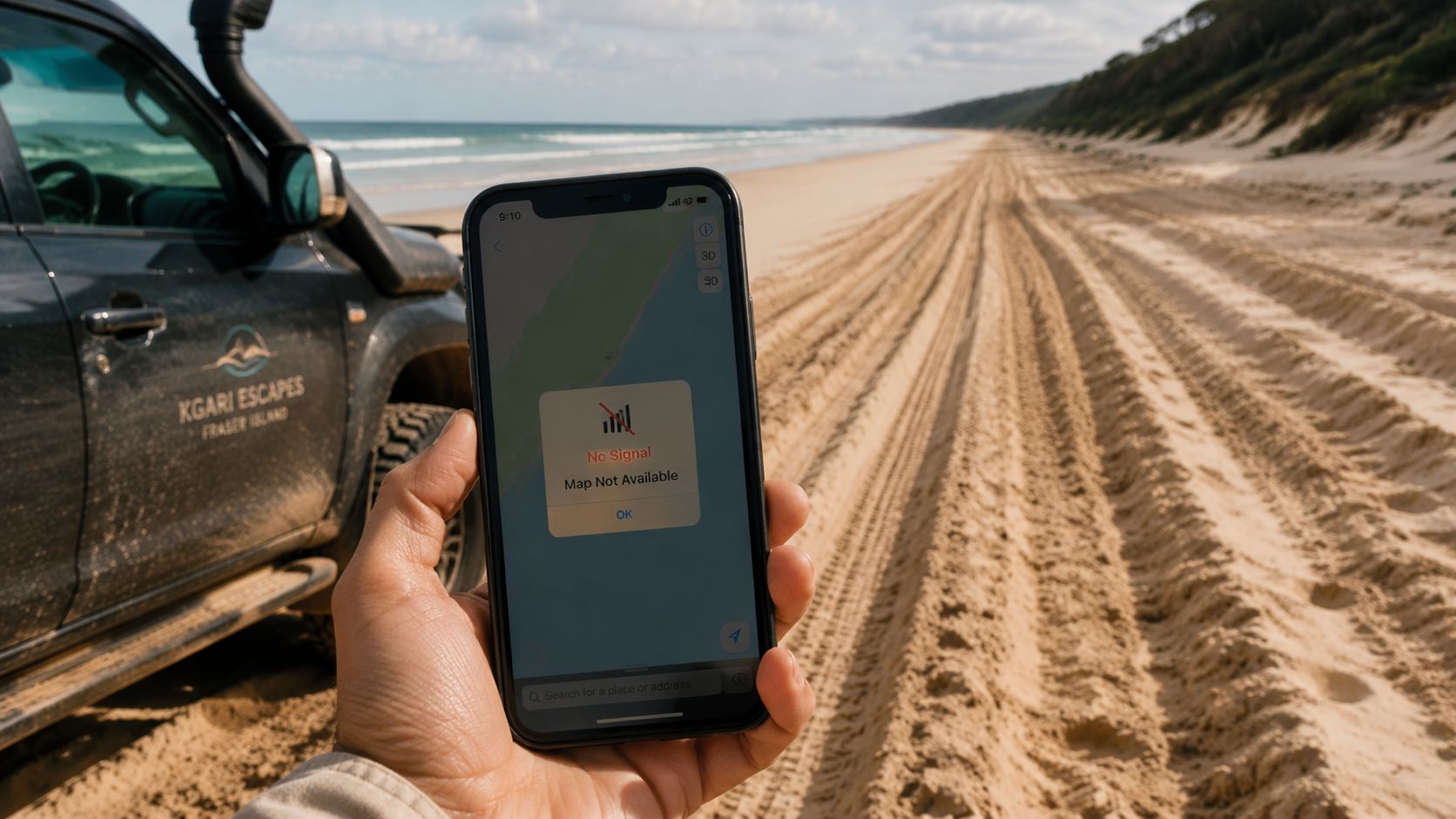
A phone map is fine for finding a bakery in a country town. It's not enough for K'gari.
That's not snobbery. It's the same logic as using the right oil in a Beetle or the right parts in a restoration. Generic tools work in generic conditions. K'gari isn't generic.
Stretching 123 km in length and covering 166,000 hectares, K'gari (Fraser Island) is the world's largest sand island, a vast terrain where navigation requires more than just a standard GPS, according to this Fraser Island map overview.
Sand tracks aren't suburban streets
Phone apps tend to treat roads as fixed things. K'gari tracks don't always behave like that. A route can look straightforward on a broad consumer map and feel very different once you're bouncing through soft sand, reading side tracks, or trying to work out whether that turn is the right one.
The problem isn't only signal. It's context.
A proper island map gives you the sort of detail that matters in real driving conditions:
- Track identity: Is this a main inland route or a softer connecting section?
- Practical landmarks: You need more than a blue dot. You need camp zones, creek crossings, lakes, and known access points.
- Decision support: Specialised maps help you judge the route before you're committed to it.
Generic navigation can make a simple day hard
A lot of travellers assume the beach will be the easy bit and the inland sections will sort themselves out. That's backwards thinking. On K'gari, a casual wrong turn can chew up time, fuel, and confidence fast.
I think of it the same way I think of an outback glovebox kit in an old VW. You wouldn't head bush with only guesswork and optimism. You'd pack what fits the terrain.
That same road-trip mindset is captured nicely in this Australian outback map feature. It's the same lesson in a different setting. A map isn't décor. It's gear.
A phone tells you where you are. A purpose-built map helps you decide whether you should be there at all.
Respect the island and the trip gets better
The funny thing is that proper prep doesn't make the journey feel less adventurous. It makes it more enjoyable. You stop second-guessing every turn and start noticing the good stuff. The colours in the sand. The odd silence between patches of scrub. The relief of rolling into camp with enough daylight left for a cuppa.
That's why Fraser Island maps matter so much. They don't kill the romance. They protect it.
Your K'gari Map Toolkit From Paper to Pixels
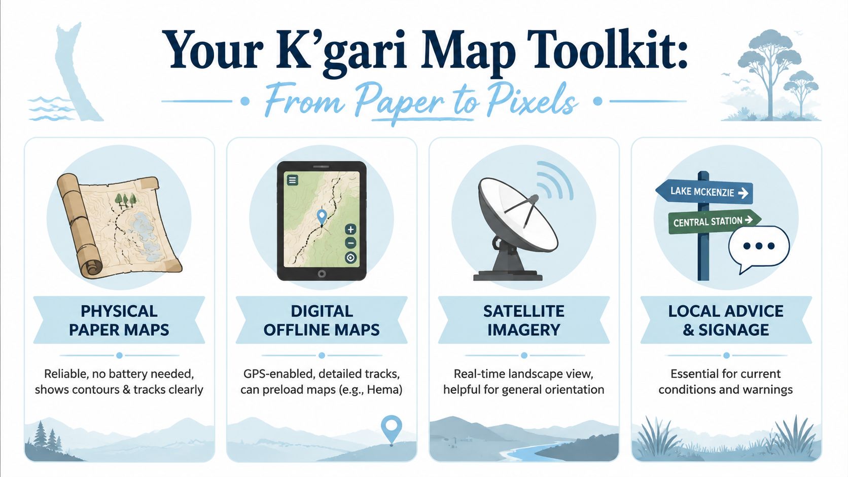
The best setup isn't one map. It's a small toolkit, with each piece doing a different job.
That's familiar territory for VW people. A diecast collector doesn't confuse a shelf-piece Samba Bus with a pocket-sized Beetle. Same badge, different purpose. K'gari navigation works the same way. One map gives you broad orientation, another gives track detail, and another helps with local rules on the ground.
The definitive topographic map for Fraser Island is produced by Hema Maps at a 1:130,000 scale, featuring GPS-surveyed 4WD tracks that have been field-checked by the Hema Map Patrol to ensure accuracy and safety, as described on the Hema Fraser Island map listing.
The paper map that earns its keep
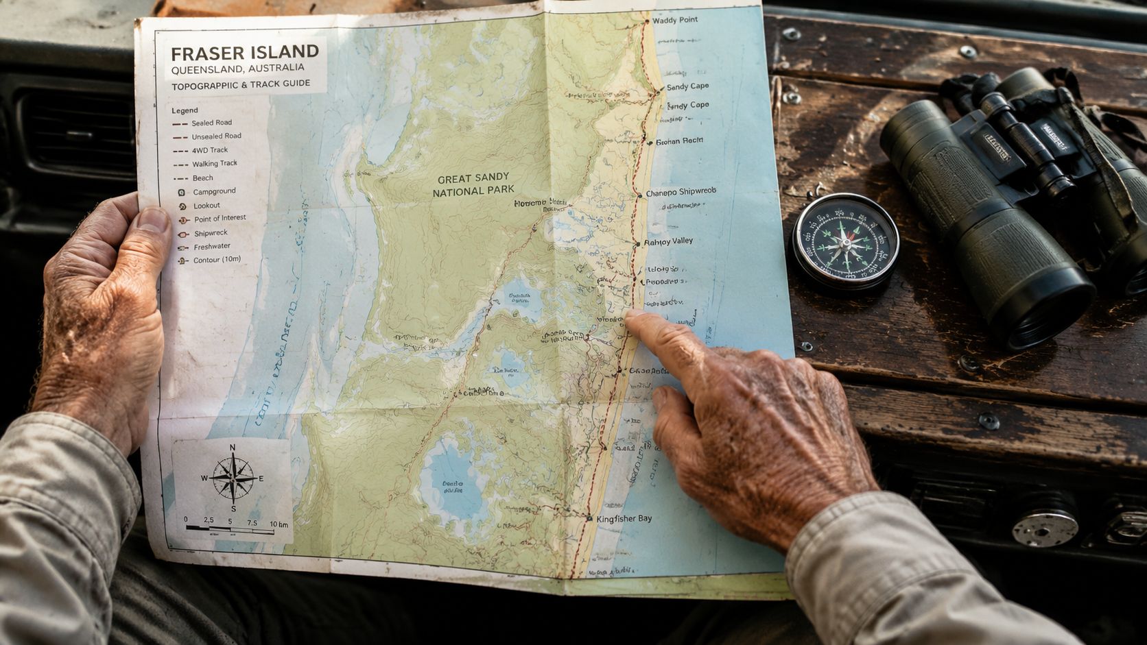
The Hema map is the one I'd want folded in the door pocket.
It's practical, readable, and built for the job. On an island where battery life, glare, and wet fingers can all become annoyances, paper still has a lot going for it. You can spread it across the bonnet, trace a route with one finger, and get everybody in the vehicle looking at the same plan.
What makes it valuable isn't nostalgia. It's reliability.
The digital layer that helps in real time
Offline digital maps add convenience. A moving position marker can be a gift when tracks branch, visibility drops, or fatigue creeps in late in the day.
The trick is using digital tools as a support act, not the whole show. Download what you need before you leave the mainland. Check that the map data is available offline. Then carry charging gear and a backup plan.
A simple way to think about it:
| Tool | Best use | Weak spot |
|---|---|---|
| Paper topographic map | Big-picture route planning and backup | No live position marker |
| Offline map app | On-track confirmation and quick checks | Battery and device dependence |
| Local signage | Immediate warnings and site rules | Limited area coverage |
| Satellite view | General orientation | Not enough detail on its own |
The official map you shouldn't ignore
There's another map category people sometimes treat as secondary, and that's a mistake. Official park material matters because it reflects current management priorities on the island, especially around camping, access, and wildlife safety.
Some of the most useful information isn't glamorous. It's the note near a zone. The fence symbol. The warning panel you skimmed the first time and then wish you'd studied properly later.
Practical rule: Carry one map for navigation and another for rules, zones, and safety notices. They solve different problems.
Local advice is part of the toolkit too
The smartest travellers on K'gari don't act like the map is the final word. They use it alongside current advice from the barge, rangers, accommodation desks, and posted signs.
That mix of old-school and modern feels very VW, really. A classic shape with a sensible upgrade. The spirit stays the same. The reliability gets better.
If you're building your own Fraser Island maps toolkit, keep it simple:
- Start with a trusted topographic map: This is the backbone.
- Add an offline app: Good for confirming your position.
- Use official park material: Especially for camps, restrictions, and safety obligations.
- Listen locally: Conditions on the day matter as much as planning at home.
How to Read the Signs and Sandy Tracks
Owning the map isn't the same as understanding it. K'gari has its own language, and once you learn it, the island feels much less mysterious.
The first time an individual studies a specialised island map, they often look for the big-ticket spots. Lake McKenzie. Eli Creek. The famous beach run. Fair enough. But the experienced driver's eye goes somewhere else first. Track type, junction logic, access notes, and where one decision commits you to another.
Read the route before the destination
That sounds obvious, but it's where plenty of planning goes soft. People choose a landmark first and only later realise the route includes slow inland work, beach timing, or a combination of both.
When I look at Fraser Island maps, I try to answer four questions before I care about scenery:
- How do I enter and exit the route?
- What kind of track am I committing to?
- What are the obvious bailout points if plans change?
- What rules apply where I stop?
That approach isn't glamorous. It is effective.
What the important symbols are really telling you
Different map makers use slightly different styling, but the important cues are consistent enough to learn.
- Main beach routes: These tend to be visually obvious, but they still demand judgment.
- Inland connector tracks: These deserve closer attention. They can turn a short-looking hop into a proper slog.
- Camping areas and facilities: Mark these early so you're not making late decisions when everyone's tired.
- Safety and restricted areas: Don't skim past them. They often shape the whole day.
A map legend is a bit like an old VW workshop manual. Boring until it suddenly saves you.
Signs on the island matter as much as lines on paper
A common mistake is treating on-ground signage as confirmation only. On K'gari, signs can change the meaning of your plan. They tell you what's happening where your printed map can't update itself.
That's why I always tell people to pause at intersections, information boards, and access signs rather than just glancing at them through the windscreen.
You don't read K'gari once at home. You keep reading it all day.
Track-reading habits worth building
Here, confidence grows. Not from bravado, but from routine.
| Habit | Why it helps |
|---|---|
| Stop and orient the map properly | Reduces wrong turns at busy junctions |
| Mark likely lunch or rest points | Prevents rushed choices later |
| Note camp zones early | Helps you avoid hunting for options when daylight fades |
| Cross-check signs with your plan | Keeps you aligned with current conditions |
There's a nice parallel here with classic VW driving. You learn the quirks. You stop fighting them. Then the whole machine starts making sense.
If you like mechanical planning as much as trip planning, the mindset isn't far off what's covered in this high-lift jack bracket installation guide. Read carefully, understand the parts, and things work better when the pressure comes on.
The Digital Co-Pilot Your Best Apps and GPS Options
The modern answer isn't paper versus digital. It's paper plus digital.
That's the sweet spot. A paper map gives you perspective. An offline app gives you confidence at the fork in the track when everyone in the cabin suddenly has an opinion.
What digital tools do well
Offline map apps are excellent for confirming where you are in relation to the route you planned. They're quick, visual, and handy when you don't want to unfold a large paper sheet in the wind.
Satellite imagery can help with broad orientation too. It gives you a feel for shape and surroundings. What it doesn't do well is replace a proper track map built for 4WD travel.
A dedicated GPS unit can also make sense if you prefer a device that's built to stay mounted, powered, and visible all day. That's especially appealing if your phone is also handling photos, messages, and booking confirmations.
What still matters before you board the barge
Digital convenience only works if you've prepared it properly. The main jobs are simple:
- Download the maps in full: Don't assume they'll cache what you need.
- Check the app while still on the mainland: Open the relevant area and make sure it works offline.
- Pack charging options: Cables, battery pack, in-car power.
- Keep a paper backup: If a screen dies, the day doesn't need to.
Digital tools are a co-pilot. Don't give them the keys.
A VW-friendly way to think about it
If you've ever fitted a discreet modern stereo into a classic Kombi, you already understand the philosophy. The upgrade doesn't ruin the character. It supports the experience.
That's exactly how digital navigation should feel on K'gari. Use the convenience. Keep the analogue backbone. Let each tool do what it does best.
For those interested in items such as VW Kombi diecast Australia, Volkswagen Beetle model, buy diecast Kombi, VW memorabilia collectibles, or Volkswagen diecast models for sale, there's a similar principle in collecting too. The best collections balance looks, authenticity, and usefulness. A trip kit should do the same.
Map to Memory Planning Your Unforgettable K'gari Trip
A map becomes exciting when it stops being paper and starts becoming a story.
You can see that shift at the kitchen table. Someone circles a lake, someone else points to a beach run, and suddenly the trip has shape. Morning ferry. Inland turn-off. Lunch spot. Camp by late afternoon. The route starts to feel real.
The weekend warrior run
This is the trip for people who want a proper taste without trying to conquer the island in one hit.
You arrive with a clear plan, use your main map to identify a sensible inland route to a central highlight, and keep your day conservative. One major destination, one secondary stop, and plenty of breathing room. The joy here is not trying to cram every famous name into one daylight window.
What makes this style work is restraint. You leave enough margin for delays, pauses, and those moments where everybody wants to get out and stare at the place.
The relaxed multi-day escape
A longer stay changes the tone completely. You can build your route in layers, with one day focused on central inland experiences, another on beach travel and scenic stops, and another on slower exploration around camp and nearby points of interest.
Your map toolkit really earns its keep. Paper for planning the overall rhythm. Offline navigation for day-to-day checks. Signage and official safety information for what's happening on the ground.
One issue still catches people out. A critical gap in current resources is the lack of guides that integrate offline map navigation with real-time dingo safety protocols, a significant issue given that up to 40% of visitors report encounters and new protocols for K'gari are often poorly mapped, according to the K'gari parks map material.
That means your itinerary shouldn't only answer where you'll drive. It should answer how you'll behave when you stop.
- At camp: Know the zone and the rules before arrival.
- At lakes and picnic areas: Read local notices instead of relying on memory.
- Around food and gear: Treat wildlife safety as part of route planning, not an afterthought.
Here's a bit of moving inspiration before wheels hit the sand:
The non-driver's version still deserves a proper plan
Not everybody heads over in their own 4WD. Some travellers join guided transport or organise the day around access to major attractions without self-driving.
That doesn't make maps irrelevant. It makes them more useful in a different way. You use them to understand where you're going, what the day can realistically include, and how each stop relates to the wider island. You become a better passenger, a calmer traveller, and a smarter planner.
The best map doesn't just get you there. It helps you remember why each stop mattered.
Years later, that's what sticks. The route line. The lake turn-off. The sandy note scribbled in the margin. It's the same reason people keep old registration papers, faded touring stickers, and tiny VW models on shelves. They're reminders that freedom is sweetest when you can still trace the road back.
Your Adventure Awaits Grab Your Map and Go
K'gari rewards the kind of traveller who loves both freedom and preparation. That's why it sits so neatly beside the old Volkswagen spirit. The dream is open-road simplicity. However, the best trips come from caring about the details.
Good Fraser Island maps give you that edge. They help you choose the right toolkit, read the track properly, combine paper with digital backup, and shape a trip that feels loose and memorable without being careless.
That's the sweet spot. Sand in the tyres, confidence in the plan, and enough room in the day for the unexpected good stuff.
If you're heading over soon, get your maps sorted before the ferry ramp drops. Learn the symbols. Respect the signs. Build an itinerary that leaves margin for weather, wildlife, and the little detours that make the story worth retelling over a cold one later.
And if the trip is still a dream for now, that's alright too. Half the pleasure has always been in the planning.
When you want to keep that road-trip feeling alive at home, have a look through Volkswagen Memorabilia. It's a lovely spot for VW fans, collectors, and gift buyers chasing licensed pieces with real character, from classic Kombi and Samba Bus diecast to Beetle-inspired keepsakes, all backed by local Australian stock and fast shipping.